

VANCOUVER: (778)658-6633 | CALGARY: (825)425-3347 | SASKATOON: (306)979-8900 | WINNIPEG: (431)816-2044 | TORONTO: (647)559-7989 | FREDERICTON: (506)405-2460 | HALIFAX: (902)706-8284 | ST.JOHN'S: (709)705-6242
MUNICIPAL CASE STUDIES
Explore real-world stories from municipalities using our systems to improve visibility, reduce manual work, and make better operational decisions.

Located in rural Manitoba, the Rural Municipality of Prairie Lakes serves a population of approximately 1,700 residents across a large geographic area with demanding year-round operational requirements. From snow clearing and grading to roadside mowing and culvert management, municipal staff require accurate, real-time operational awareness to maintain service levels and respond to public concerns efficiently.
To improve operational visibility and accountability, the RM implemented ConX Wireless systems across multiple assets including road graders, highway mowers, haulage trucks, and an X-it infrastructure marking device used for identifying culverts and municipal assets.
For CAO Kevin Cameron, the greatest benefit has been having immediate access to meaningful operational data — not just vehicle health statistics.
“It’s all been working really good. I can tell where equipment is and what roads are getting done, whether it’s grading, snow blowing, or plowing. We used it with our Kubota tractor and snowblower, which was great because we bill people. If someone says we haven’t been there, I can pull it up and say, ‘Well, he was there for 45 minutes three days ago.’”
This ability to verify completed work has significantly improved operational confidence and reduced uncertainty when responding to resident inquiries or billing-related questions. Instead of relying on radio communication, handwritten notes, or operator recollection, the RM now has timestamped digital records and map-based verification available instantly.
The municipality’s public-facing Snow Map has also become an important communication tool for both council and residents.
“My councillors use the Snow Map all the time. A couple of them are pretty faithful at it, and sometimes they tell me where they think my operators are before I even know.”
The system provides live and historical mapping that distinguishes between simple vehicle travel and actual work activity. This distinction is especially important during grading and snow-clearing operations where knowing whether a blade is engaged matters more than simply knowing where a machine traveled.
Kevin Cameron noted that while many municipalities assume OEM telematics systems such as JDLink provide everything needed operationally, there is an important difference between equipment diagnostics and operational intelligence.
“JD Link tracks things like engine RPM and what gear they’re in, but it doesn’t tell me if the blade is up or down or if the operator is actually doing the work. That’s the kind of info I get from the ConX system, and that’s what I really need.”
This difference has become increasingly important for municipalities focused on accountability, reporting, and operational efficiency. Traditional manufacturer telematics platforms are excellent at monitoring equipment health, maintenance intervals, fuel usage, and fault codes. However, they typically do not provide the municipal-specific workflow information required by public works departments.
The ConX system focuses specifically on municipal operations:
• Identifying when actual work is being performed
• Distinguishing travel time from productive work time
• Providing public snow-clearing visibility
• Tracking mowing completion
• Recording historical operational evidence
• Improving response to ratepayer complaints
• Simplifying operational reporting to council
• Supporting billing verification for contracted services
Another major advantage for Prairie Lakes has been the platform’s manufacturer-agnostic design. Unlike OEM systems tied to a specific brand of equipment, the ConX systems operate across virtually all manufacturers and mixed municipal fleets.
This allows the RM to maintain consistent reporting and operational standards regardless of whether equipment is manufactured by John Deere, Kubota, Caterpillar, Case, or others. For municipalities operating diverse fleets over long replacement cycles, this creates continuity and avoids fragmented reporting systems.
The RM’s use of the X-it infrastructure marking system has also improved the municipality’s ability to identify and manage culvert and roadside asset locations more efficiently. Staff are able to digitally document and locate important infrastructure while improving long-term asset visibility.
For the Rural Municipality of Prairie Lakes, the result has been more than GPS tracking alone. The municipality has gained a clearer understanding of field operations, improved communication with council and residents, and stronger operational accountability across daily municipal activities.
As municipalities continue looking for ways to improve efficiency while meeting growing public expectations, Prairie Lakes demonstrates the value of moving beyond basic equipment telematics toward systems specifically designed for municipal operations.
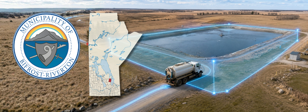
Located in the heart of Manitoba’s Interlake region, the Municipality of Bifrost-Riverton has embraced connected technology to modernize operations, improve accountability, and streamline municipal services for both staff and residents.
Today, the municipality operates an expanding suite of ConX Wireless solutions across multiple departments, including:
• 3 Road Graders with GPS tracking and operational reporting
• 6 Smart Septage Disposal Systems (SDS)
• 5 GPS Fleet Tracking Devices
• Smart Water Fill Systems
Through the use of ConX Wireless hardware, mapping, reporting, and automation tools, the municipality has significantly improved operational visibility, public communication, billing accuracy, and day-to-day efficiency.
Smart Septage Disposal System (SDS)
One of the Municipality’s most impactful upgrades has been the implementation of the ConX Smart Septage Disposal System. Prior to deployment, septic disposal usage relied largely on an honour-based process with limited accountability or measurable usage data.
With the ConX SDS platform now in place, the municipality can accurately track haulers, record disposal activity, and automatically bill according to actual usage.
“We at the Municipality of Bifrost-Riverton love your system, both the GPS in our Graders and the Septic Hauling tracking! We are now able to record the Septic Haulers and bill them according to usage. This has more than paid for the system.”
The municipality reports that the system has transformed lagoon management and operational oversight.
“Our Smart Septage system is working great and has been going very well. Before this, we didn’t have anything in place other than an honour system, so this has been a big improvement. The system works as it should and the haulers don’t mind using it at all.”
The municipality also recognized the long-term financial value and operational intelligence the system provides.
“ConX Wireless is awesome! Great service and speedy response time! We recently ordered the Sewage Tracker and I am very excited to start the program! The system will pay for itself and provide actual data on our Lagoon use!”
By capturing real-time usage data, the municipality now has measurable insight into lagoon demand, user activity, and infrastructure utilization — information that supports future planning, budgeting, and environmental oversight.
Road Maintenance Visibility & Public Accountability
The Municipality of Bifrost-Riverton also utilizes ConX GPS systems throughout its grader fleet and municipal operations. The platform provides live equipment visibility, route history, service verification, and detailed reporting capabilities.
For municipal management and public works staff, access to factual operational data has become an essential daily tool.
“The ConX system is an absolute gem! It allows me to log in and see if a road has been serviced when a rate payer calls in and says ‘You haven’t been down my road in a few months’. I can relay back the information to that rate payer in a quick and efficient manner.”
The ability to defend operations with accurate mapping and historical records has also helped improve communication with Council and reduce unnecessary disputes or uncertainty.
“I report our operational progress to council, monthly. The maps and reports I generate in ConX’s system allow me to give an accurate and detailed view of what work has been done to date. This limits the number of questions councillors have for me.”
Municipal operators and management alike benefit from the transparency and accountability the system provides.
“We’ve been using the ConX Wireless system in our graders and GIS operations for a few years now. It is an essential tool for me in my day-to-day operations. I know where my operators are and where they’ve been with a few clicks of a button. This helps me immensely when I’m dealing with rate-payer complaints. I can easily defend my employees’ actions with factual evidence.”
Reliable Support & Customer Service
Beyond the technology itself, municipal staff consistently highlighted the responsiveness and support provided by the ConX Wireless team.
“When I have had a question or needed assistance, the ConX customer support team has been very prompt and helpful. I think any public works operation would benefit greatly from the solutions ConX Wireless can provide.”
Improved Water Fill Operations
The municipality also implemented five ConX Wireless Water Fill Systems to modernize public water access and reduce manual handling processes.
The improvements have simplified operations for both municipal staff and the public.
“Our five ConX Wireless Water Fill Systems have made things so much more efficient and saved us a lot of time. I’m one of the people at the front who deals with the public, and it’s definitely easier now. I used to be the one rolling all the quarters, loonies, and toonies, so I really appreciate the time I save not having to do that anymore.”
The automated system reduces cash handling, improves transaction tracking, and provides a cleaner, more efficient customer experience.
A Municipality Connected for the Future
By integrating ConX Wireless technology across road maintenance, septage tracking, GIS operations, fleet monitoring, and water services, the Municipality of Bifrost-Riverton has built a more connected, accountable, and data-driven operation.
The result is improved service delivery, reduced administrative workload, better communication with residents and council, and measurable operational efficiencies that continue to deliver value year after year.

Across rural Canada, municipalities are being asked to do more with less—maintain expansive road networks, manage rising equipment costs, respond to ratepayer expectations, and document operations with greater precision than ever before.
For the Rural Municipality of Britannia with a population of 2,000+, meeting those challenges has increasingly meant embracing technology that improves visibility, accountability, and operational efficiency.
Today, Britannia’s public works operation is supported by 35 pieces of municipal equipment equipped with ConX Wireless monitoring devices, including graders, highway mowers, heavy haulage trucks, ½ and ¾ ton trucks, loaders, buggies, semi-trucks, backhoes, and an asset marking device.
What began as a fleet tracking investment has evolved into a much broader operational management system—one that supports planning, reporting, asset utilization, material tracking, and day-to-day decision-making across the municipality.
For a rural municipality responsible for extensive road maintenance and infrastructure oversight, the ability to know where equipment is, what it is doing, and how efficiently it is operating has become a significant operational advantage.
From Fleet Tracking to Operational Intelligence
Britannia uses ConX devices as much more than simple GPS locators. The system has become a working management platform that helps municipal staff monitor activity in real time, review historical performance, organize crews, document work completed, and improve communication between administration and field operations.
For Foreman Barry K., that visibility has changed how the municipality monitors its equipment and workload.
“The system allows us to track our graders and see what work is being done and where it’s happening across the RM. It provides the information we need to monitor operations and understand what equipment is working on and where it’s been. Being able to see that level of detail is helpful for managing our fleet and keeping track of the work being completed.” - Barry K., Foreman
That visibility matters in practical ways every day. Road maintenance can be confirmed. Equipment deployment can be optimized. Questions about whether work has been completed can be answered with confidence. For municipal leadership, that creates stronger documentation and operational proof. For field staff, it supports better coordination.
Saving Time. Improving Accountability.
One of the clearest benefits Britannia has realized is administrative and supervisory time savings.
Operations Manager Michael Glavin uses the system daily and describes it as a core management tool:
“I use the system every day. It helps to organize the crews and allows me to see what has been completed. We will be using it for more of what it offers by Fall; tracking gravel volume, spreading materials, and using geozones to see when operators are coming and going. Making a report for a unit and what they did that day is easy. It saves me probably half an hour a day for each of our five graders alone.” - Michael Glavin, Operations Manager
That kind of time reduction scales quickly. Saving even 30 minutes per grader per day translates into substantial annual productivity gains. But beyond time savings, the system has improved reporting confidence and reduced manual effort in assembling operational records.
Tasks that once relied on memory, handwritten notes, or radio communication can now be documented through data. That means easier reporting, better resource planning, and stronger support when responding to public inquiries or council questions.
Material Tracking Innovation that Grew Beyond Britannia
One of Britannia’s standout examples of value came through a practical operational challenge.
The municipality needed to track material from 25 different gravel pits—well beyond the original software limit of nine. Rather than treating that as a fixed constraint, ConX responded by expanding the platform dramatically.
As CAO Bryson Leganchuck explains:
“ConX Wireless really goes out of their way to make sure everything works for you the way you need it to. When we needed to track material from 25 different pits, the system was originally limited to just 9. I brought it up to them, and they took it seriously because next thing we knew, they upgraded it to handle 99 pits for us and apparently all their other Municipal clients for free.
That upgrade made a huge difference for us because we were at a bit of a standstill without it, and I really appreciate how they stepped up to make it happen.” - Bryson Leganchuck, CAO
That enhancement did more than solve a local issue. It expanded functionality for municipalities across the ConX client base.
For Britannia, it meant improved gravel source tracking, stronger material accountability, and a system that adapted to real-world municipal needs instead of forcing operations to fit software limitations.
35 Connected Assets, One Coordinated Operation
With ConX devices attached across 35 equipment assets, Britannia has moved toward a more connected public works model.
That includes:
✓ Grader productivity and route monitoring
✓ Highway mowing verification
✓ Heavy haul and truck activity tracking
✓ Loader and backhoe utilization analysis
✓ Material hauling and gravel spread documentation
✓ Geozone-based arrival/departure monitoring
✓ Asset marking and infrastructure reference
✓ Historical playback and unit-specific reporting
This breadth matters because municipal operations are interconnected. A grader’s route affects hauling needs. Gravel movement affects budgeting. Equipment utilization affects replacement planning. Having those activities visible in one system strengthens decision-making.
Benefits Beyond Operations
Britannia’s use of ConX has also produced less obvious—but equally important—benefits.
Improved Ratepayer Response
When residents raise concerns about grading frequency, road servicing, or response times, staff have documentation to support responses.
Better Equipment Utilization
Knowing where machines are being used and how often supports more informed asset management.
Operational Proof and Protection
Documented work activity provides confidence when responding to council, audits, complaints, or operational questions.
Future-Ready Expansion
Britannia continues expanding into advanced features such as geozones, material-volume tracking, and enhanced reporting—leveraging more value from infrastructure already in place.
A Partnership, Not Just a Product
Perhaps one of the strongest themes in Britannia’s experience is that the value has not come from hardware alone. It has come from the responsiveness behind it.
The 99-pit upgrade illustrates a broader point: technology delivers the most value when providers adapt alongside municipal users.
For Britannia, that partnership approach appears to have mattered as much as the platform itself.
A Modern Rural Municipality Model
The Rural Municipality of Britannia demonstrates how rural municipalities can use connected technology not simply to “track trucks,” but to modernize operations.
Through 35 connected assets, real-time visibility, labor-saving reporting tools, advanced material tracking, GeoZone, and fleet accountability, Britannia has built a stronger, more data-informed public works operation.
And as their use of the platform continues to grow, the benefits appear to be compounding.
For municipalities looking to improve accountability, efficiency, and operational awareness without adding unnecessary administrative burden, Britannia’s experience offers a compelling example of what’s possible with ConX Wireless.

The Rural Municipality of Golden West has embraced a practical, forward-thinking approach to municipal operations by integrating ConX Wireless devices, software, and reporting tools across its fleet and infrastructure. Operating three graders, two mowers, and an X-it culverts marking system, the RM has transformed how it monitors work, communicates with leadership, and delivers service to its ratepayers.
At the core of this transformation is visibility. With ConX systems in place, staff and leadership now have real-time access to the exact location and activity of equipment. As one municipal leader explains:
“The ConX Systems have been a great addition to managing our RM's operations! I like the ability to instantly see where graders and other equipment are. This has been especially great for mowing, to keep track of what has been done and plan for where to go next.”
This level of insight has proven especially valuable during peak seasonal operations like mowing. Instead of relying on radio calls or manual updates, staff can make immediate, informed decisions based on live data. The system has also eliminated administrative burdens:
“We receive automatic monthly reports for both our Graders and Mowers, and I love not having to generate them myself. I forward these reports to Council each month, which keeps them in the know of what has been done.”
Council engagement has improved significantly as well. With direct access to the system, elected officials can independently view operations in real time:
“Our Reeve likes being able to log into his account and see where equipment is at… This allows him to answer phone calls/complaints without a middle man.”
This transparency has dramatically improved response times to ratepayer concerns, reducing internal bottlenecks and strengthening public trust:
“Being able to quickly check the location of our graders… has made a big difference… That way ratepayer questions or complaints can be answered or fixed right away.”
Beyond tracking, ConX has delivered operational clarity. One standout feature is blade position tracking on graders:
“Our favorite thing is that it actually shows blade up and blade down… Having that detail is huge!”
This capability ensures accurate verification of completed work, eliminating ambiguity and enabling data-backed conversations with operators when needed:
“The minute a ratepayer calls… I can do a quick search and say, ‘Actually, they were there last week.’”
The mower tracking system has also provided unexpected but critical value:
“The Mower system has been wonderful… One of the operators… had a habit of getting lost… I could find him when he went missing… and couldn’t tell anyone where he was.”
Safety, accountability, and operational efficiency all benefit from this level of oversight.
Golden West has also advanced its asset management practices using the X-it culvert marking device:
“We just finished marking our culverts… that was an absolute breeze. I am looking forward to utilizing the digital map… for Asset Management purposes.”
With tools like Road-Segment Analytics and Snow Maps, the RM is now positioned to quantify road value, support grant applications, and visually communicate work completed:
“This snow removal map was really awesome… council [can] see where the graders had been… they don’t have to call me.”
The result is a more efficient, transparent, and data-driven municipality—one that is not only improving internal operations but also setting a benchmark for others.
“I’m a huge fan of the ConX Systems and always recommend it… I have nothing but good things to say.”
For the RM of Golden West, ConX Wireless isn’t just a tracking system—it’s become an essential operational backbone that enhances accountability, improves service delivery, and empowers better decision-making at every level.